Uleytokpo
-
General Information
Other Name: -, District: Leh, State: Jammu & Kashmir, India
Area: 0
Languages Spoken: Kashmiri, Hindi, Urdu
Long Distance Code: 01928
Importance: -
Best Time to Visit: March to October and -
International Access: -
Description
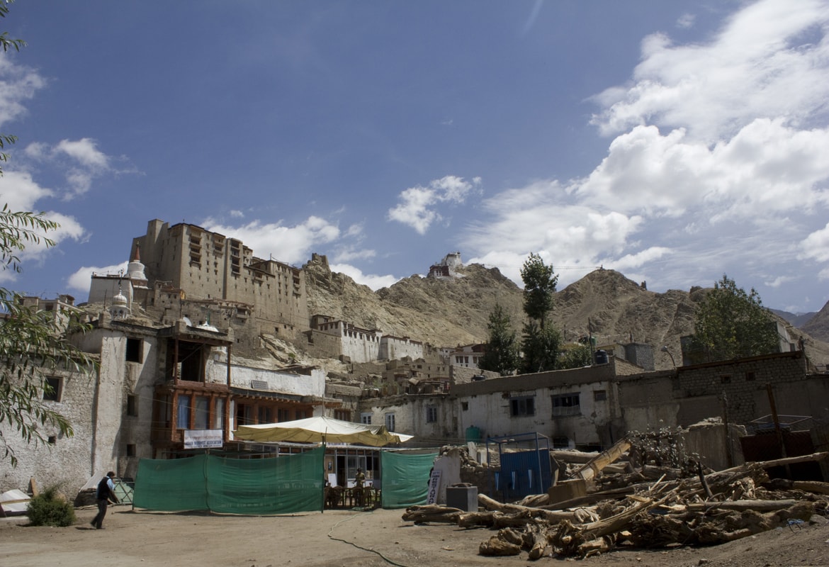
A scenic and ultimate destination blessed with breath taking natural beauty and rich heritage, Uleytokpo village is located in the Leh district of Jammu and Kashmir. It is an idyllic place for spending the vacations in a peace-loving and serene area. A place not yet homogenized by globalization or overcrowded by modernization, the barren landscape of the place will never cease to enchant you. This place is famous for it's apricot orchards.Location
Situated more than 3000m above the sea level and 80 kms from Leh.Climate
Sub Tropical weather. Stays warm in the summer and extremely cold in the winter.

Namgyal Dynasty "Ladakh" / PC-604 (13 Days / 12 Nights)
Delhi-Leh-Uleytokpo-Uleytokpo – Ridzong – Lamayuru – Uleytokpo-Uleytokpo-Leh-Khardongla pass-Nubra (DISKIT & HUNDER)-NUBRA VALLEY-Nubra-Leh-Chumathang – Tsomoriri-Tsomoriri-Korzok-Puga – Tsokar – Tanglangla-Leh-Delhi
Ladakh is a land like no other. Bounded by two of the world's mightiest mountain ranges, the Great Himalaya and the Karakoram, it lies athwart two other, the Ladakh range and the Zanskar range. In geological terms, this is a young land, formed only a few million years ago by the buckling and folding of the earth's crust as the Indian sub-continent pushed with irresistible force against the immovable mass of Asia. Its basic contours, uplifted by these unimaginable tectonic movements, have been modified over the millennia by the opposite process of erosion, sculpted into the form we see today by wind and water. Yes, water! Today, a high -altitude desert, sheltered from the rain-bearing clouds of the Indian monsoon by the barrier of the Great Himalaya, Ladakh was once covered by an extensive lake system, the vestiges of which still exist on its south -east plateau of Rupshu and Chushul - in drainage basins with evocative names like Tso-moriri, Tsokar, and grandest of all, Pangong-tso. Occasionally, some stray monsoon clouds do find their way over the Himalaya, and lately this seems to be happening with increasing frequency. But the main source of water remains the winter snowfall. Drass, Zanskar and the Suru Valley on the Himalaya's northern flank receive heavy snow in winter; this feeds the glaciers whose melt water, carried down by streams, irrigates the fields in summer. For the rest of the region, the snow on the peaks is virtually the only source of water. As the crops grow, the villagers pray not for rain, but for sun to melt the glaciers and liberate their water. Usually their prayers are answered, for the skies are clear and the sun shines for over 300 days in the year. Ladakh lies at altitudes ranging from about 9,000 feet (2750m) at Kargil to 25,170 feet (7,672m) at Saser Kangri in the Karakoram. Thus summer temperatures rarely exceed about 27 degree celcius in the shade, while in winter they may plummet to minus 20 degree Celsius even in Leh. Surprisingly, though, the thin air makes the heat of the sun even more intense than at lower altitudes; it is said that only in Ladakh can a man sitting in the sun with his feet in the shade suffer from sunstroke and frostbite at the same time!
Detailed Itinerary
Day 1 : Delhi-Leh
Day 2 : Leh
Day 3 : Leh-Uleytokpo
Day 4 : Uleytokpo – Ridzong – Lamayuru – Uleytokpo
Day 5 : Uleytokpo-Leh
Day 6 : Leh-Khardongla pass-Nubra (DISKIT & HUNDER)
Day 7 : NUBRA VALLEY
Day 8 : Nubra-Leh
Day 9 : Leh-Chumathang – Tsomoriri
Day 10 : Tsomoriri
Day 11 : Korzok-Puga – Tsokar – Tanglangla-Leh
Day 12 : Leh
Day 13 : Leh-Delhi
Uleytokpo, India Tours